UN
9 The Loning
£ 580,000
Description
We don't have a Description for this property.
- Bedrooms
- 3
- Bathrooms
- 0
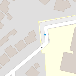

Leaflet © OpenStreetMap contributors
The heatmap indicates the level of crime in the area. The color of the heatmap indicates the crime severity and recency.
Metrics Year-on-Year
- Average area value
- 448,251.00 £Decreased by 4.47 %
- Average area rental value
- 2,138.00 £/moIncreased by 14.52 %
- Est rental Yield
- 5.72 %Increased by 19.92 %
- Crime Rate
- 2.00 %Unchanged by 0.00 %
from 469,242.00 £
from 1,867.00 £/mo
from 4.77 %
from 2.00 %
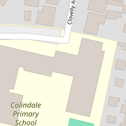
Nearby Schools
| Name | Type | Ofsted | Distance |
|---|---|---|---|
| Colindale Primary School | Community School | Good | 0.18 KM |
| North London Grammar School | Other Independent School | Outstanding | 0.69 KM |
| The Hyde School | Academy Sponsor Led | Outstanding | 0.88 KM |
| First Rung Independent School | Other Independent School | Good | 0.98 KM |
| Saracens High School | Free Schools | 1.13 KM |
Images
Nearby Streets
| Name | Average Price | Average Sqft | Distance |
|---|---|---|---|
| The Loning | £ 535,000 | 1,596 | 0.00 KM |
| Bute Close | £ 600,000 | 0 | 0.00 KM |
| Lismore Boulevard | £ 375,000 | 0 | 0.00 KM |
| Aerial Square | £ 0 | 0 | 0.00 KM |
| Colindale Gardens | £ 0 | 0 | 0.00 KM |
Nearby Transport
| Name | NLC | TLC | Distance |
|---|---|---|---|
| Hendon | 1522 | HEN | 1.49 KM |
| Mill Hill Broadway | 1527 | MIL | 2.54 KM |
| Cricklewood | 1519 | CRI | 5.22 KM |
| Wembley Stadium | 1509 | WCX | 5.83 KM |
| Stonebridge Park | 1454 | SBP | 6.04 KM |
Nearby Listings
| Address | Price | Type | Score | Distance |
|---|---|---|---|---|
| Colindeep Lane, Colindale, London, NW9 | £ 475,000 | BUY | 7 / 10 | 0.13 KM |
| Marlow Court, Colindeep Lane, London, NW9 | £ 370,000 | BUY | Unknown | 0.15 KM |
| Chalfont Court, Colindale | £ 324,950 | BUY | Unknown | 0.17 KM |
| Colindeep Lane, Colindale, London, NW9 | £ 600,000 | BUY | 7 / 10 | 0.19 KM |
| Colindeep Lane, London, NW9 | £ 675,000 | BUY | 7 / 10 | 0.22 KM |
Nearby Properties
| Address | Price | Distance |
|---|---|---|
| 11 The Loning | £ 325,000 | 0.00 KM |
| 3 The Loning | £ 355,000 | 0.00 KM |
| 31 The Loning | £ 455,000 | 0.00 KM |
| 9 The Loning | £ 580,000 | 0.00 KM |
| 4b The Loning | £ 84,000 | 0.00 KM |